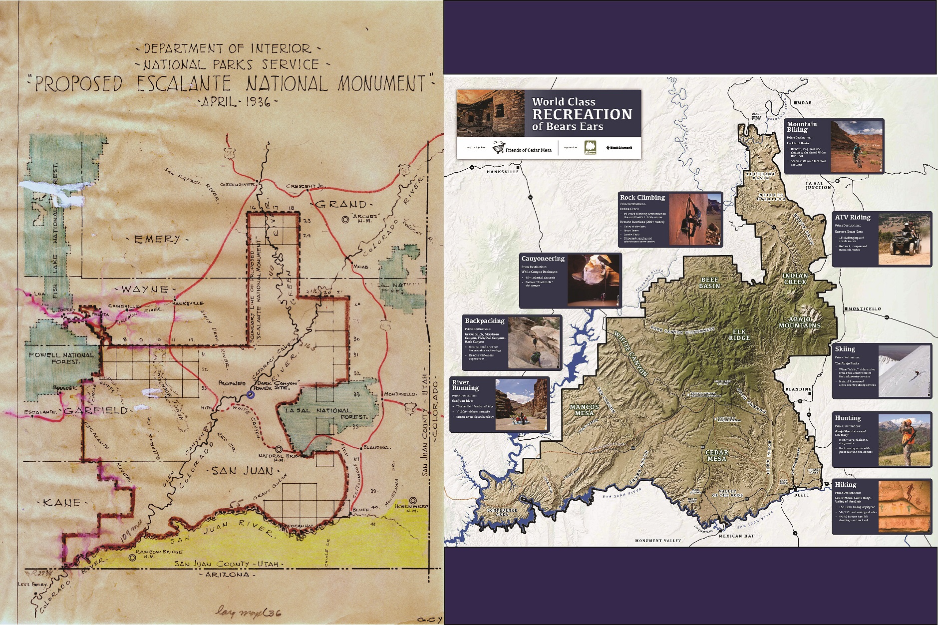
Eighty years ago, the US Department of the Interior produced a map for a proposed Escalante National Monument that would protect millions of acres of public land in Southern Utah. That vintage map has a lot in common with a more recent map that illustrates the many outdoor recreation opportunities on the proposed Bears Ears National Monument. These two maps demonstrate that the idea of protecting lands in Southern Utah is nothing new. The current proposal for the Bears Ears would protect nearly two million acres of land, preserving the area’s rich archaeological history and many outdoor recreation amenities. The maps are a good reminder that conservation can take a long time, but that good ideas generally win the day in the end. We hope that the vision DOI forwarded in 1936 finds final success in 2016.