By Joel Webster, Western lands director for the Theodore Roosevelt Conservation Partnership. Photo Credit: Mark Good
Why a national coalition of hunting and fishing groups is calling for use of a new conservation tool to keep backcountry public lands intact and undeveloped.
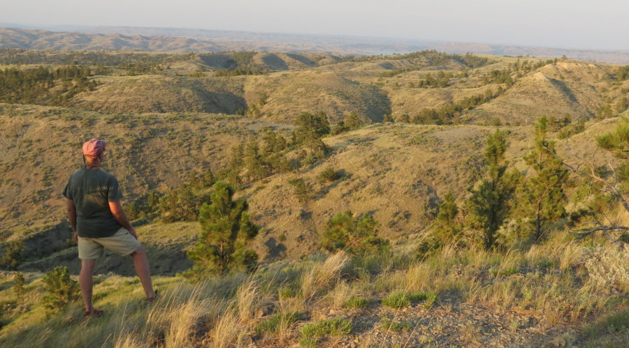
Thousands of years ago, the Missouri River in Montana ran far north of where it lies today. As the ice ages ended, the river took a new course below the Bear Paw Mountains, cutting a wide channel through the fine clay soils of the plains. Rain and snow have since carved the earth into a vast and twisted maze of coulees and canyons, some of them hundreds of feet deep, marked by cliffs of yellow sandstone, weathered buttes, steep slopes of scree rock, and forests of ponderosa pine.
The Breaks were one of the last places to be settled in the West. Much of the land went unclaimed. A lot more was abandoned after the homestead years, when fierce winters and seemingly endless droughts forced even some of the toughest families to leave.
Today, most of the Missouri Breaks is public land in the care of the Bureau of Land Management and the U.S. Fish and Wildlife Service. It is known by wildlife enthusiasts as some of the world’s most unique and productive country for elk, mule deer, and bighorn sheep. The river is popular for multi-day float trips and the almost never-ending canyons are great for camping, hiking, and exploring. Many of us are accustomed to going up into the mountains to find solitude and adventure, but in the Breaks, the mountains head downhill, eventually leading to the big river itself.
Lands on the southern end of the Missouri breaks—not far from where the Missouri and Musselshell Rivers meet—are currently being evaluated by the BLM, and what they find will shape long-term future management of these areas. In February 2014, the BLM formally began the process of revising the Lewistown Field Office Resource Management Plan to guide use of its resources for the next two decades.
And this planning process represents a rare and critical opportunity to protect our last remaining undeveloped lands from fragmentation and development.
These are some of the most unique backcountry lands found anywhere, and they will remain vulnerable to fragmentation and development unless safeguarded through the land-use plan. That’s why the Theodore Roosevelt Conservation Partnership (TRCP)—a national coalition of 46 hunting and fishing conservation organizations—is leading a public outreach campaign to convince the BLM to safeguard the best backcountry lands on the southern side of the Breaks.
The TRCP and its allies are advocating for a meaningful new conservation tool called Backcountry Conservation Areas (BCAs). Through the BCA approach, specific areas important for wildlife habitat and dispersed recreation would be safeguarded from fragmentation and development through the revised land-use plan. In essence, it would keep backcountry BLM lands just the way they are.
In 2014, the TRCP worked closely with the diverse group of people who have a stake in public lands management to develop a proposal identifying 230,000 acres of backcountry lands worthy of conservation. Six hunting and fishing groups, plus 800 individuals, a local rancher, and other stakeholders, have expressed support for this proposal. Outdoor recreation groups and businesses have also been strong supporters of the BCA management approach.
Right now, the BLM is making final touches to its draft resource management plan, and we expect this plan to be issued to the public later this year. But your opportunity to help safeguard one of the most unique and scenic landscapes in North America is now. Contact the Lewistown BLM and urge them conserve the best backcountry in the Missouri River Breaks by adopting backcountry conservation areas in the Lewistown resource management plan. Your days of hunting, fishing, or spending time with family on central Montana’s public lands depend on it.